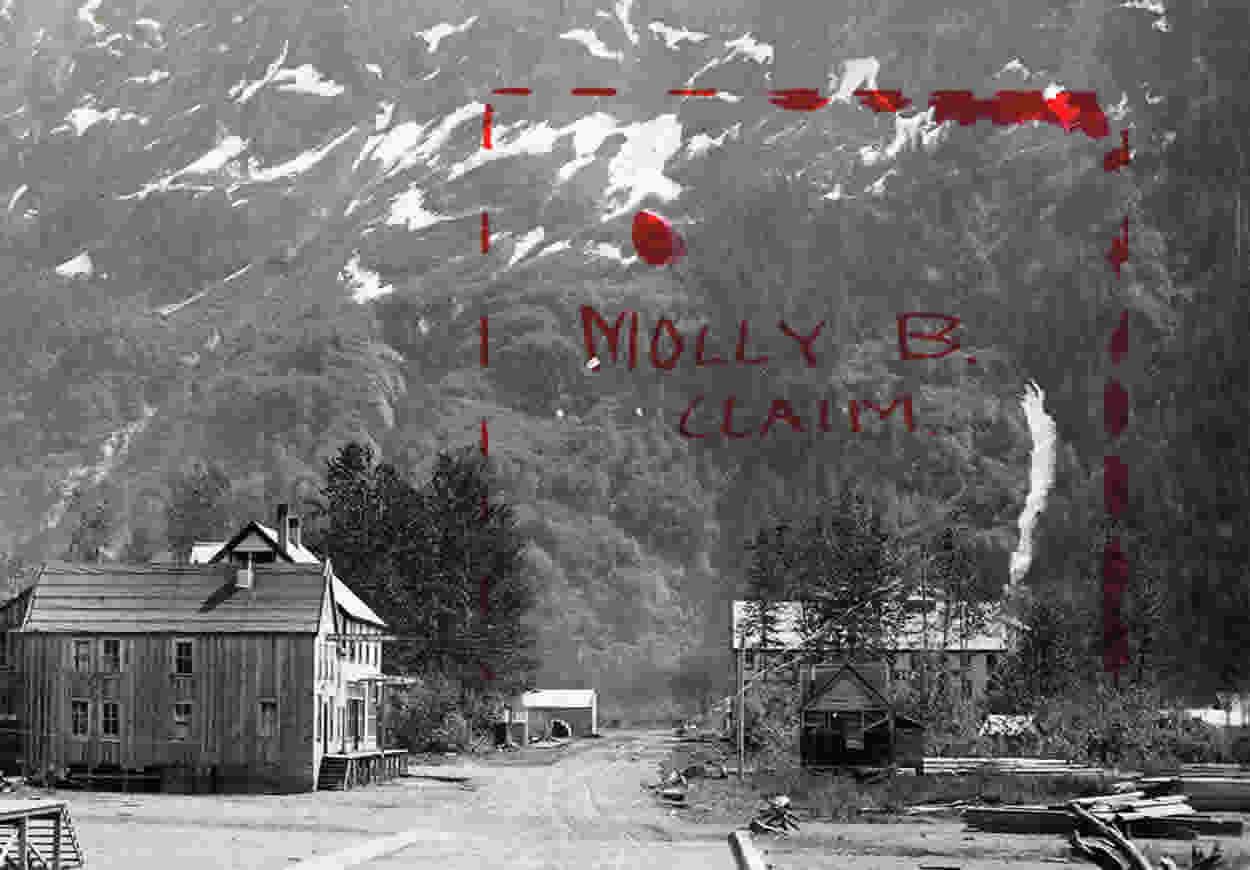
MOLLY B CLAIM
The Molly B Crown-granted claim (Lot 4498) is on the east side of the Bear River directly in line with the main street and opposite the airport. It was staked by D. J. Rainey, of Stewart, who first sampled the mineralization in 1915.
In 1917 the Molly B group was worked by the owners, J. W. Stewart and associates, whoLooking up Bear Valley to Stewart from the Molly B. Bear River on right = airport in middle = Stewart on left. opened several cuts and prepared a tunnel site. The tunnel was continued in 1918 and molybdenite samples were shipped for assay. As part of the group encompassed about a quarter of the Skamakounst Indian Reserve 19, negotiations with the band chief were necessary.
In 1937 the area was prospected in conjunction with surface work on the adjoining Oral M group by the Premier Gold Mining Co. Ltd. In 1942, J. Haahti, of Stewart, sent three samples of tungsten-molybdenite mineralization from the main adit vein to the Prince Rupert sampling plant, and in 1946 Stewart Canal Gold Mines Ltd. extended the adit and sampled the mineralization.
No further work on the property has been reported, but Haahti is known to have continued driving the adit. A sketch of the main adit on the east bank of the Bear River at elevation 30 feet is shown on Figure 32. The geology and other pertinent sample information which was included in Bulletin 10 (revised), pp. 54-56, as reported by W. H. Mathews, has been quoted in the following:-
The workings consist of four open-cuts and one short adit on the steep hillside above the Bear River. The lowermost open-cut, at elevation 10 feet, has been driven south-easterly for 10 feet, the adit, at elevation 30 feet and 12 feet easterly from the last open-cut, has been driven south-easterly for 10 feet. An upper open-cut, at elevation 50 feet and 40 feet easterly from the lower open-cut, has been driven easterly 6 feet, another open-cut, at elevation 90 feet and 60 feet easterly from the middle one, has been driven easterly for 6 feet.
The uppermost open-cut, at elevation 105 feet and 12 feet easterly from the last, has been driven easterly for 5 feet. They have all been driven on the same mineralized bed.
The scheelite and molybdenite are found in a band of lime-silicate rock formed by high-temperature replacement of a bed of limestone. This bed, which strikes south 60 degrees east and dips from 65 to 75 degrees southwestward, is 8 feet in width in the lowest open-cut, but decreases gradually to a thickness of 2 feet up the hill, then, where next exposed, in the open-cut at elevation 50 feet, it is 4 feet in thickness, and finally, in the uppermost open-cut at elevation 105 feet, it abruptly narrows from 4 feet to less than an inch. The bed can be traced for only a few feet beyond this cut.
The rock, originally an impure limestone, has been metamorphosed to a mixture of diopside, garnet, and epidote. Calcite, which may or may not be part of the original limestone, is found in places. This bed, evidently favourable for replacement, has been mineralized with scheelite, moiybdenite, and pyrite.
The adjacent beds, both above and below the mineralized bed, consist of hard, relatively thin-bedded tuff or impure quartzite, often containing significant amounts of lime-silicate minerals, but no excess caicite, and probably for this reason they were unfavourable for mineralization.
The grade of the molybdenite and scheelite is not high. A 360-pound shipment sent to the Government Sampling Plant at Prince Rupert of hand-sorted material taken from the lowest open-cut assayed: Molybdenum, 4.2 per cent, and tungstic oxide (WO3), 1.5 per cent. Impurities included:-
Per Cent Per Cent
Iron --------------- 11.0 Copper --------------------- Trace
Sulphur ---------- 3.5 Arsenic --------------------- Trace
Silica ------------ - 40.4 Manganese ---------------0.9
Zinc ---------------- 0.4 Tin ------------------------------Trace
Phosphorus ---- 0.24 Antimony --------------------Nit
Lead -------------- Trace Bismuth --------------------Nil
A channel sample, taken across the face of the adit, a length of 5V2 feet, assayed:
Tungstic oxide (WO3), 0.37 per cent; molybdenum (Mo), 0.17 per cent.
A second channel, taken across 4 feet on the cut 90 feet above the river level, assayed:
Tungstic oxide (WO3), 0.22 per cent; molybdenum (Mo), 0.02 per cent.
A 148-pound sample blasted from the lowest cut and from the face of the adit assayed:
Tungstic oxide (WO3), 0.15 per cent; molybdenum (Mo), 0.2 per cent.
Examination with an ultra-violet lamp shows that scheelite is present throughout the exposures, with somewhat lower grade in the constricted parts of the bed than elsewhere.
Occasionally high-grade streaks or patches of scheelite-bearing material are found, but these are not sufficiently large to form shipping ore.
Elsewhere scheelite is too fine-grained or too uniformly distributed to permit any appreciable concentration by hand-sorting. It is doubtful whether the molybdenite shows the same uniformity of grade throughout the deposit as does the scheelite; in general, it appears to be concentrated in the lower exposures.
The mineralization, consisting of quartz-sulphide vein breccia and scattered tactite, is confined to a narrow, northwesterly trending shear zone opposite Stewart.
Sulphides recognized in the narrow lenses include pyrite, pyrrhotite, chalcopyrite, sphalerite, and molybdenite. These are also found as disseminations in cataclastic rocks near joint planes.
Scheelite appears to be confined to lenses of tactite which are composed of epidote and garnet and are best exposed in the open cuts.
